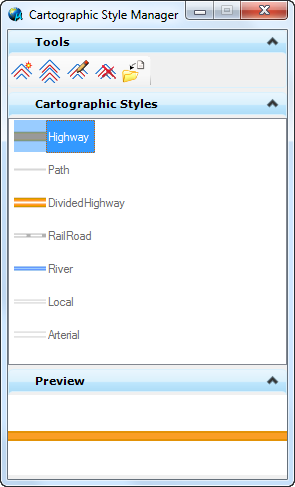
Cartographic Styles Manager
Cartographic styles are used to enhance the look of a map by improving the look of linear elements and the intersections of those elements. Cartographic Styles are assigned by the Map Manager wherever any linear style is called. This includes symbology overrides and thematic maps.
Cartographic Styles do not create new elements; the representation is only a display feature.
A number of standard styles are provided. Styles defined in a file located in the path listed in the MS_DGNLIBLIST environment variable are displayed in grey.
A context menu is available by right clicking on a style. Options are Duplicate, Edit and Delete. If edit is selected on a read-only style a dialog will prompt the user to make a local copy.

The preview section shows an image of the selected cartographic style.
Cartographic Style Tools
| Tool | Icon | Operation |
|---|---|---|
|
Create |
Creates a style in Device or in Master units. See more details below. |
|
|
Duplicate |
Creates a copy of the selected styles and appends 'Copy' to the name. |
|
|
Edit |
Opens the Cartographic Style Editor dialog. |
|
|
Delete |
Removes the selected selection from the current model. |
|
|
Import |
Imports all styles saved in another model. |


